
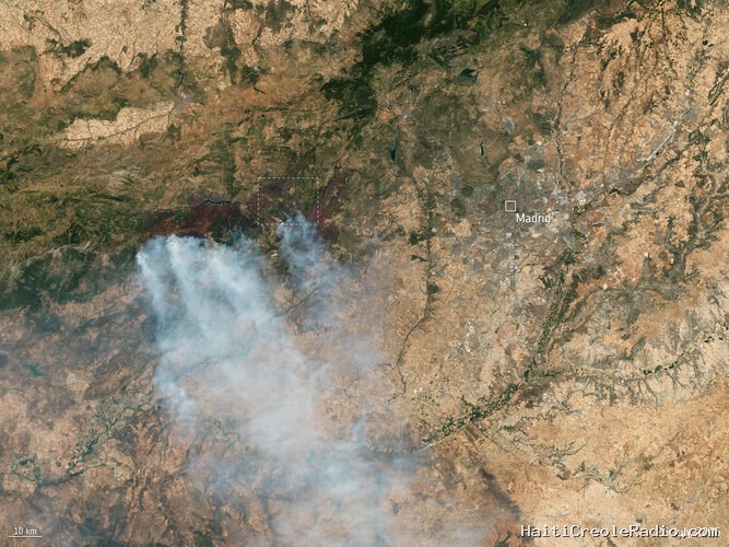
This Copernicus Sentinel-2 image, captured on 26 July, shows a wide view over the wildfires to the west of Madrid, Spain.
The area around the town of Ávila, about 100 km northwest of the Spanish capital was one of the worst affected areas the outbreak of fire in Spain. More than 90 000 people were evacuated from the region over the weekend.
The European Union’s Copernicus Emergency Mapping Service was activated on 23 July to monitor and provide emergency mapping data on the wildfires in central Spain.
The Sentinel-2's near-infrared channel has been used to highlight the active fire fronts. Each of the Sentinel-2 satellites carry an innovative wide swath high-resolution multispectral imager with 13 spectral bands for a detailed view of land and vegetation.
A zoomed-in view over ESA's Cebreros ground station – see area marked – was also captured by Sentinel-2 on the same day.



Commentaires (0)
Laisser un commentaire
Aucun commentaire. Soyez le premier !